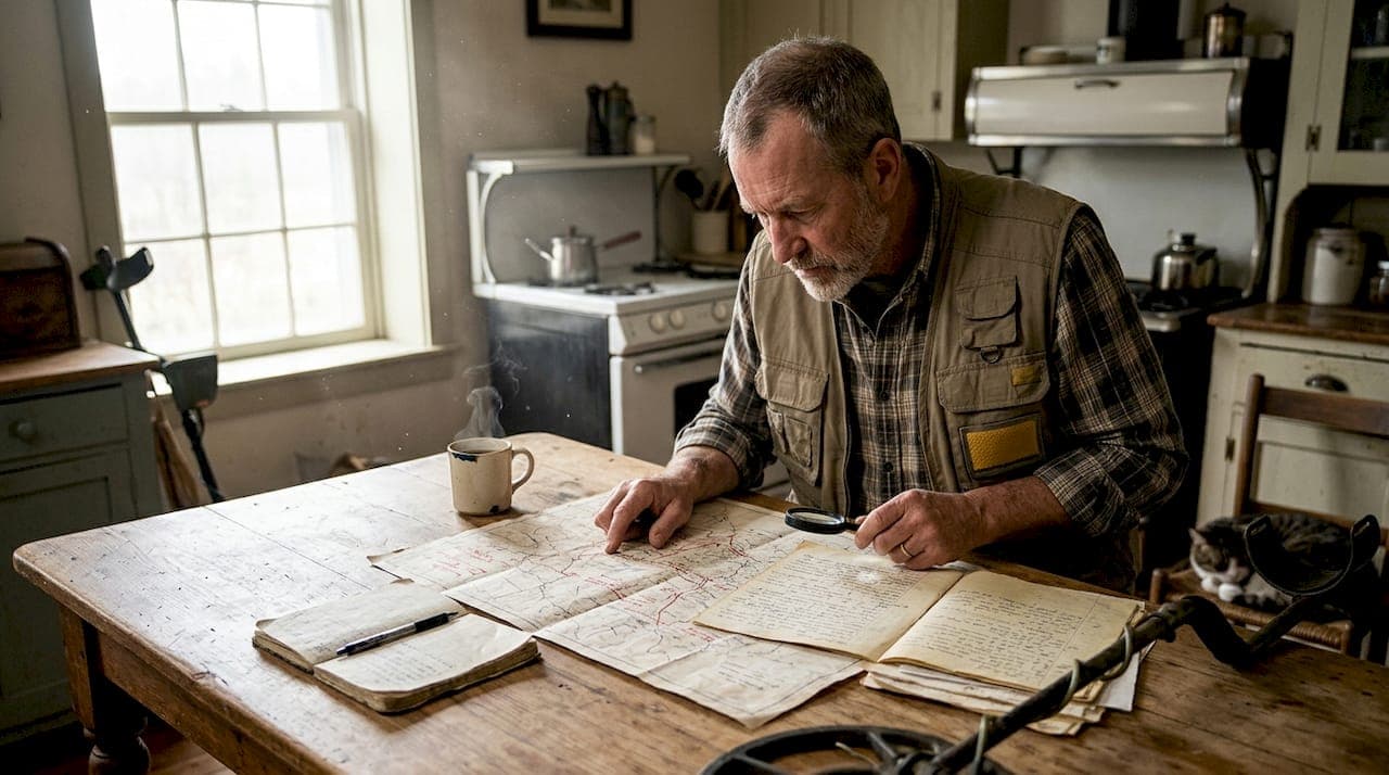
Most treasure hunters have felt it: you spend weeks researching a promising site, drive hours to reach it, and return home with nothing but a handful of corroded nails and a sense of defeat. The problem rarely comes down to bad luck. More often, it traces back to a fragmented workflow, skipping non-invasive survey steps, missing key archival sources, or failing to document finds in a way that supports meaningful analysis. A structured, technology-driven research workflow changes all of that. This article walks you through every critical stage, from initial historical research to ethical reporting, so your fieldwork produces results that matter.
Table of Contents
- Foundations: Key steps in the historical research workflow
- Preparation: Tools and technologies for advanced site discovery
- Execution: Applying surveys, remote sensing, and field documentation
- Verification: Analysis, interpretation, and reporting for lasting value
- Why mastering workflow beats luck: Hard-won lessons from the field
- Supercharge your workflow with PinPoint Treasure
- Frequently asked questions
Key Takeaways
| Point | Details |
|---|---|
| Stepwise workflow matters | Following a proven sequence leads to more successful and ethical discoveries. |
| Technology amplifies results | Advanced tools like LiDAR, AI, and open-source software dramatically expand research potential. |
| Documentation ensures legacy | Careful record-keeping secures context and value for future research and legal compliance. |
| Ethics protect knowledge | Responsible reporting and local consent safeguard both heritage and your reputation. |
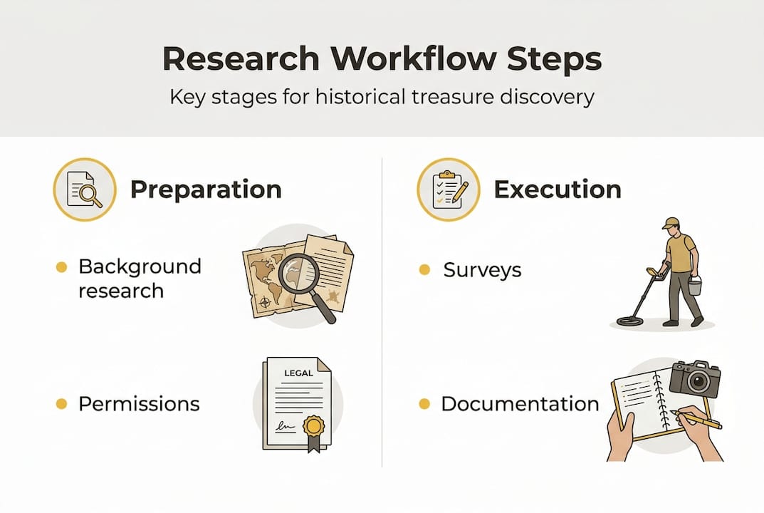
Foundations: Key steps in the historical research workflow
Having set the stage for why workflow matters, let's break down the process itself. The archaeological research workflow begins with background historical research, moves through non-invasive surveys using remote sensing technologies like LiDAR, GIS, and metal detecting, then proceeds to targeted excavations, artifact analysis, and interpretation. That sequence is not arbitrary. Each stage builds on the last, and skipping steps creates gaps that are nearly impossible to fill after the fact.
Here is how the full workflow breaks down in practice:
- Background research — Study historical maps, land records, newspaper archives, and oral histories to identify candidate sites.
- Remote sensing survey — Apply LiDAR, aerial photography, and GIS analysis to detect terrain anomalies without disturbing the ground.
- Non-invasive field survey — Walk the site with metal detectors, conduct ground-penetrating radar (GPR) passes, and collect surface observations.
- Targeted excavation — Based on survey data, open precise test units or trenches at the highest-probability zones.
- Artifact analysis — Clean, catalog, and examine recovered materials using typology, XRF (X-ray fluorescence), and comparative databases.
- Interpretation and reporting — Integrate findings into the broader historical narrative and submit to relevant reporting platforms.
| Stage | Key action | Output |
|---|---|---|
| Background research | Archive and map review | Site candidate list |
| Remote sensing | LiDAR and GIS analysis | Anomaly map |
| Field survey | Metal detecting, GPR | Target zones |
| Excavation | Controlled digging | Recovered artifacts |
| Analysis | XRF, typology | Authenticated finds |
| Reporting | Documentation, submission | Heritage record |
Documentation at every stage is non-negotiable. A find without provenance is a story without context. For broader treasure hunting tips and site selection strategies, building strong archival habits early pays dividends throughout the entire process. You can also cross-reference your candidate sites against documented cases by exploring historical legends to prioritize the most historically significant targets.
Pro Tip: Maintain both a digital field log (cloud-synced) and a physical backup notebook. Technology fails in the field. Your records should not.
Preparation: Tools and technologies for advanced site discovery
With the basic workflow in view, let's look at the tools that shape success and how they compare. Modern treasure hunting and historical research have converged around a powerful set of technologies that, used together, dramatically improve your odds of identifying significant sites before you ever break ground.
The LiDAR processing workflow for archaeological sites uses UAS (unmanned aerial systems) or drone data, open-source machine learning tools like Random Forest in CloudCompare for point cloud classification, and generates DTMs (Digital Terrain Models), DFMs (Difference from Mean), and DSMs (Digital Surface Models) to reveal hidden features under vegetation. That kind of capability, once limited to university research teams, is now accessible to independent researchers.
Core tools you should know:
- LiDAR scanner or drone-mounted sensor — Captures high-resolution elevation data to detect buried structures, earthworks, and terrain anomalies.
- GIS software (QGIS, ArcGIS) — Layers historical maps, satellite imagery, and LiDAR outputs for spatial analysis.
- Metal detector (mid-to-high range) — Essential for near-surface metallic target identification; multi-frequency models improve depth and discrimination.
- Ground-penetrating radar (GPR) — Detects subsurface voids, foundations, and dense objects without excavation.
- CloudCompare / LAStools — Open-source point cloud processing for LiDAR data analysis.
- AI research platforms — Automate archival searches and deliver GPS-tagged site recommendations.
| Tool | Function | Approx. cost | Learning curve | Effectiveness |
|---|---|---|---|---|
| LiDAR drone | Terrain mapping | $2,000+ | High | Very high |
| GIS software | Spatial analysis | Free to $1,500/yr | Medium | High |
| Metal detector | Near-surface targets | $300 to $2,500 | Low to medium | High |
| GPR unit | Subsurface imaging | $5,000+ | High | Very high |
| AI research platform | Archive and GPS data | $0 to $20/mo | Low | High |
For a deeper look at interpreting elevation data, the guide on reading LiDAR data covers practical interpretation techniques. If you are integrating detectors with digital workflows, the AI metal detecting guide offers a solid starting point for combining hardware with AI-assisted analysis.
Ethical considerations matter here too. Always verify land access permissions, understand data sensitivity for culturally significant sites, and treat every piece of context as part of the historical record.
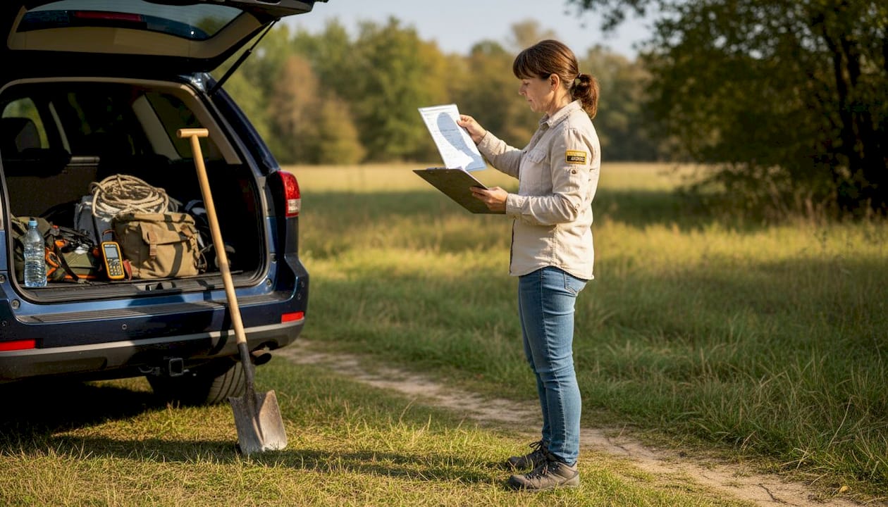
Execution: Applying surveys, remote sensing, and field documentation
Armed with the right tools, it's time to put your workflow into action in the field. Execution is where preparation either pays off or falls apart. A systematic approach to on-site surveys separates productive fieldwork from expensive guesswork.
Follow this sequence for an efficient field survey:
- Pre-field data review — Load your LiDAR anomaly maps and historical overlays onto a GPS device or tablet before arriving on site.
- Establish a grid — Mark a survey grid using stakes and flagging tape to ensure systematic coverage and prevent missed zones.
- Run LiDAR or drone passes first — Capture aerial data before any ground disturbance to preserve the baseline terrain record.
- Conduct metal detector sweeps — Work methodically across your grid, flagging signals without digging until the sweep is complete.
- Prioritize targets using signal data — Cross-reference detector signals with LiDAR anomalies to identify high-probability zones before excavating.
- Document in real time — Photograph every flagged target location, record GPS coordinates, and note soil conditions before and after recovery.
"Competency in metal detecting combines experience and equipment quality; open-source tools democratize LiDAR analysis; visualization techniques like Hillshade and Skyview enhance feature detection." — Expert nuances in archaeological technology
Visualization enhancements like Hillshade and Skyview Factor (SVF) rendering make subtle terrain features far more readable in your LiDAR outputs. These are not cosmetic adjustments. They reveal micro-topographic details that standard elevation views miss entirely. For a practical breakdown of how LiDAR fits into the broader treasure hunting toolkit, the article on LiDAR in treasure hunting covers the fundamentals clearly.
AI and machine learning are also reshaping what is possible at scale. LiDAR deep learning models achieve an F1 score of 0.89 for detecting Maya settlements across 35,584 km², a level of accuracy and coverage no manual survey team could replicate. That benchmark matters for independent researchers too, because it validates the reliability of AI-assisted detection when models are properly trained and validated.
Pro Tip: Always run a Hillshade render from at least two light angles (typically 315° and 45°) on your LiDAR DTM. Features that disappear under one illumination angle often become clearly visible under another.
Verification: Analysis, interpretation, and reporting for lasting value
After data collection, your work is just beginning. Reliable analysis and ethical reporting are what set professionals apart from hobbyists who walk away with objects stripped of meaning.
For metal-detected finds, especially hoards or multi-object assemblages, the post-detection workflow includes field survey, in-situ documentation, excavation, sieving, material analysis (such as XRF), typology, and integration into the broader archaeological context. Each of those steps adds a layer of authentication and historical value that no amount of surface-level enthusiasm can substitute.
Here is how to structure your verification process:
- In-situ documentation — Before removing any object, photograph it in place with a scale marker and record its exact GPS coordinates.
- Controlled recovery — Excavate carefully, sieve spoil for small fragments, and bag materials by context layer.
- Preliminary cleaning and cataloging — Clean objects gently, assign catalog numbers, and cross-reference with known typologies.
- Material analysis — Use XRF or send samples to a qualified lab to confirm composition, date range, and origin.
- Contextual interpretation — Place your finds within the site's historical narrative using archival records and comparative collections.
- Reporting — Submit finds to relevant platforms such as the Portable Antiquities Scheme (PAS) in the UK or DIME in Scandinavia, or work with your local heritage authority.
Ethical and legal guidelines every researcher should follow:
- Obtain all necessary permits before excavating on public or protected land.
- Never remove objects from scheduled monuments or protected heritage sites.
- Report significant finds to the appropriate heritage authority within required timeframes.
- Maintain full provenance records for every recovered object.
- Share data with researchers and institutions where appropriate.
For those newer to the field, the beginners metal detecting tips guide covers the foundational legal and ethical responsibilities that apply from your very first survey.
Avoiding false positives in AI analysis is equally important. Always validate machine-generated anomaly detections against ground-truth data before committing to excavation. AI accelerates the process, but human judgment and field experience remain the final filter.
Why mastering workflow beats luck: Hard-won lessons from the field
There is a persistent myth in treasure hunting circles that great discoveries come to those who search the most ground. The data tells a different story. Hobbyists focused on valuables risk destroying the very context that gives objects their historical and monetary significance, while professionals who prioritize systematic methods, ethical reporting through platforms like PAS and DIME, and structured documentation consistently produce finds with greater long-term value.
The uncomfortable truth is that workflow is not glamorous. It requires patience, meticulous record-keeping, and a willingness to spend more time at a desk than in a field. But the researchers who commit to this process find sites that others walk past repeatedly. They recover objects whose full story can be told, authenticated, and published. They build reputations that open doors to restricted archives and collaborative projects.
Shifting from luck-based searching to process-driven discovery also changes what you are looking for. Instead of chasing signals, you are building a case. Every piece of data, whether it is a soil discoloration or a faint LiDAR depression, becomes evidence. That mindset, more than any single piece of technology, is what separates meaningful discoveries from random finds.
Supercharge your workflow with PinPoint Treasure
Ready to put these strategies into action? The PinPoint Treasure platform integrates the full research workflow into a single AI-powered environment, from LiDAR terrain analysis using USGS 3DEP 1-meter resolution data to an AI Research Companion that searches historical archives and delivers field-ready GPS coordinates.
The platform features include anomaly visualization combining LiDAR depressions, NDVI vegetation scars, and iron oxide signatures, plus a Cipher Engine for historical cryptanalysis and a curated database of 100+ documented lost treasures. Plans start at $0 per month, with Pro access at $9.99 per month and Field Pro at $19.99 per month for GPR analysis, offline maps, and API access. Whether you are running your first survey or managing a multi-site research project, PinPoint Treasure gives you the data infrastructure to work smarter.
Frequently asked questions
What are the essential steps in a historical research workflow for treasure hunting?
The workflow includes historical research, non-invasive surveying, targeted excavation, artifact analysis, and ethical reporting, with each stage building directly on the last. The full archaeological process runs from background research through to final interpretation.
How does LiDAR improve site discovery in historical research?
LiDAR detects and maps terrain features hidden under dense vegetation by capturing precise elevation data, and paired with machine learning, it can reveal buried structures invisible to standard aerial photography.
What's the role of ethical reporting in treasure hunting?
Responsible reporting ensures that discoveries contribute to the collective historical record rather than disappearing into private collections. Professionals prioritize systematic reporting through platforms like PAS and DIME to protect site integrity and advance knowledge.
Which technologies offer the best results for large-scale site detection?
LiDAR combined with AI deep learning models delivers the strongest results at scale. These models achieve an F1 detection accuracy score of 0.89 across areas exceeding 35,000 km² when validated by field experts.
How do open-source tools impact the historical research workflow?
Open-source platforms like QGIS, CloudCompare, and LAStools make advanced LiDAR and spatial analysis accessible without expensive licensing fees. Open-source tools democratize these analyses, lowering the barrier for independent researchers and hobbyists who want professional-grade results.
Recommended
- PinPoint Treasure — AI Treasure Hunting, Gold Prospecting & Mystery Solving Platform
- PinPoint Treasure — AI Treasure Hunting, Gold Prospecting & Mystery Solving Platform
- PinPoint Treasure — AI Treasure Hunting, Gold Prospecting & Mystery Solving Platform
- PinPoint Treasure — AI Treasure Hunting, Gold Prospecting & Mystery Solving Platform